What is RING
The acronym RING (Rete Integrata Nazionale GNSS) reflects the integration of experiences maturated in a decade of geodetic activities atINGV, that since 2004, are all focused in the construction of the network. Also, RING integrates GPS receivers with broad-band seismometers and accelerometers in real time connection with three centers of acquisition. The co-location of different instruments allows us to detect all the frequency content of the earthquake process, from the inter-seismic strain accumulation on faults to the radiative part during the rupture process.
SCIENTIFIC MOTIVATION
The convergence between Africa and Eurasia across the Western Mediterranean results in a variety of small microplates whose kinematics is complex and far from being fully understood. Only recently, with the contribution of GPS data, the tectonic picture is slightly clearer but the need to increase the number of CGPS stations in key areas of Italy still remains a primary task. Moreover, there is the evidence that relative velocities are larger than thought before and that important geological processes, involving high rates of deformations, occur across many important regions.
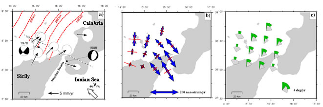
All these led, at the end of 2004, the Istituto Nazionale di Geofisica e Vulcanologia (INGV) to start an important scientific project to install in three years a GPS network composed by about 180 receivers that we called RING.
WHAT WE INSTALLED
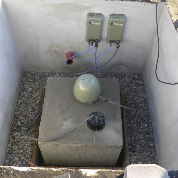
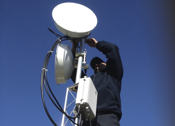
The seismometers are Trillium broad-band (40s, 120s or 240s) produced by Nanometrics Seismological Instruments Inc. from Canada, as well as the Libra-Gui satellite transmission part, and the accelerometers are the Episensor from Kinemetrics Inc.
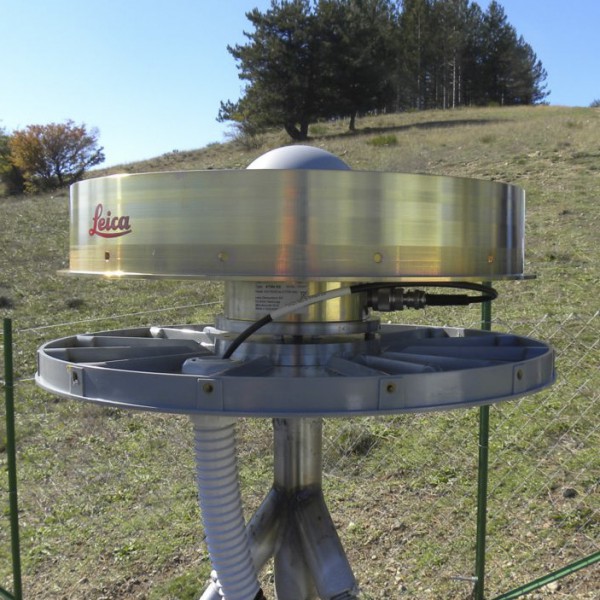
The GPS receivers have been chosen through an European comparative evaluation between the most up to date receivers. We selected the Leica GRX 1200PRO with AT504 choke-ring antenna as a standard for the network. Important parts are the antenna mount and radome from the Southern California Integrated GPS Network (SCIGN).
MONUMENTS
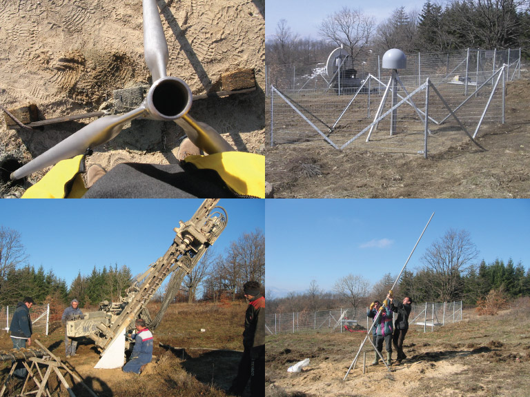
Shallow – drilled braced
We have carried out studies on the monuments optimization’s and in particular, we have introduced some significant version to the classic monument type “Short Drill-Braced” of the SCIGN.
In fact this new monument type need to use a tripode adapter, that allows us to connect the four bar in the apex, simply screwing them. In order to improve the grip inside the land, we have realized specific grooves at the bottom of the bar. At last, to facilitate the installation operations, useful guides have been designed and realized for to direct the lateral drill holes. Beside the shallow braced tripods, we also built concrete pillar monument type, anchored with four lateral rods 1 meter down into the ground. Thanks to the adaptor, the monument realisation is strongly simplified. No expert welder is needed in the field and we are now able to put in operation a receiver in less than one day.
This is also important for post-seismic studies where it is necessary to have receivers in operation as soon as possible after a large earthquake. Last but not less important is the low cost of the monument.
Deep – drilled braced
Where geological conditions are not good for shallow monuments, we are forced to make deep installations, about 10 meters, either with deep tripod or with single rod.
The GPS receivers have been chosen through an European comparative evaluation between the most up to date receivers. We selected the Leica GRX 1200PRO with AT504 choke-ring antenna as a standard for the network. Important parts are the antenna mount and radome from the Southern California Integrated GPS Network (SCIGN).
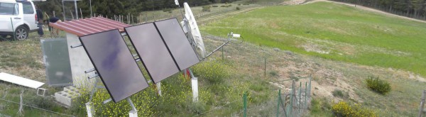
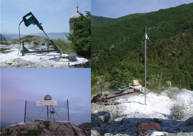
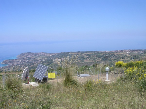
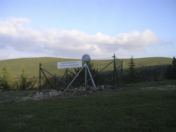
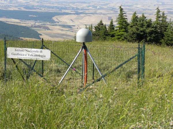
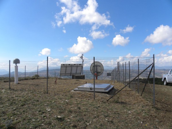
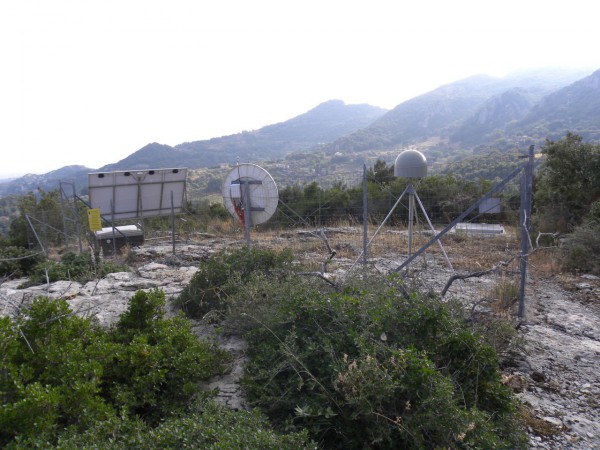
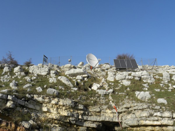
SITES
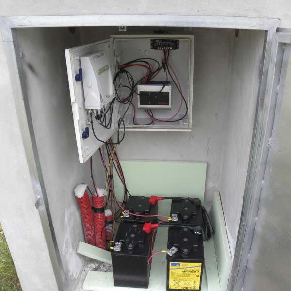
Almost all the stations are in the free field thank to the low power consumption of the satellite transmission that can be run with solar panels. The pictures show some examples of different sites.
DATA TRANSMISSION
The remote site transmit data at 30s of sampling rate in real-time streaming by the LIBRA VSAT I and II (http://www.nanometrics.ca) using Intelsat and Hellasat satellite systems. The satellite communication for the transmission of the geodetic signal has been chosen for its autonomy, reliability, simplicity, possibility to have high quality of data and economy.
As an alternative to the satellite systems some site are provided with Internet communication (by cable, Universal Mobile Telecommunications System -UMTS, Satellite Internet) or dedicated WiFi Mesh Network realized and mantained by our technicians. These infrastructure allow us to acquire data in real time at 1s of sampling rate. Data are collected at the acquisition centres located in Rome and Grottaminarda.
DATA MANAGEMENT
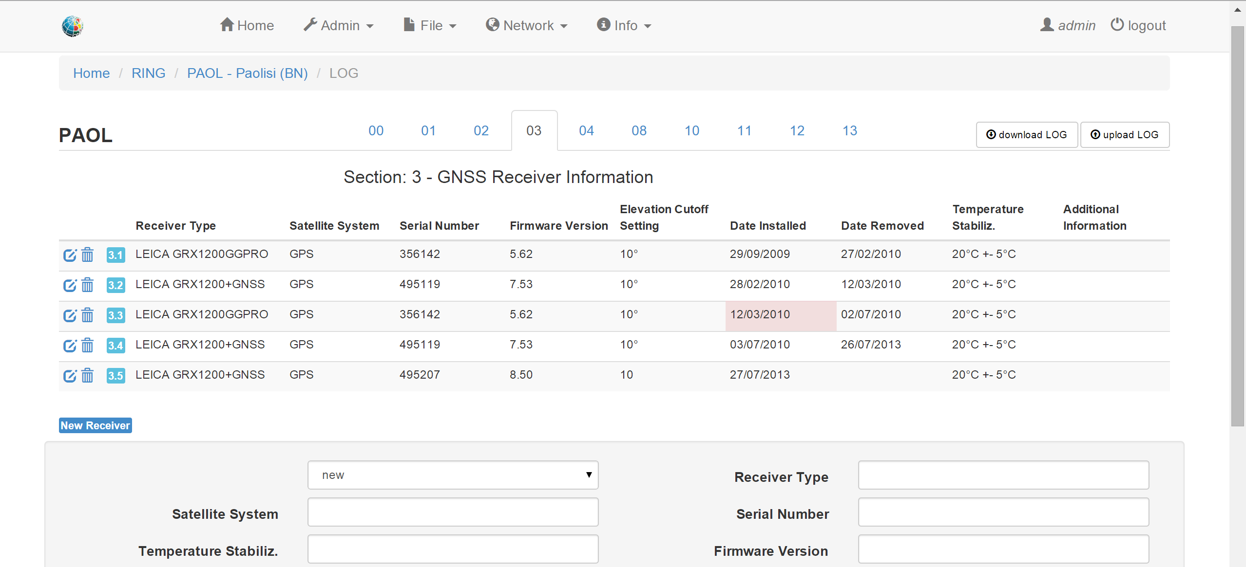
The observation files, and metadata of the RING, are managed by a Knowledge Management (KM) infrastructure finalized to the web sharing management (bancadati).The process model associated with KM consists of well-defined layer, about: data, software and web services (Presentation). Into the first layer (Data Sources Layer) the data sources is made up of file system, to manage raw data and rinex, and of relational database with Oracle technology which manage information about sites and instruments (log files, monographies etc).
The second layer (Knowledge Management Layer) is as a case of analysis and development software and data mining tools. The querying, management and sharing of all the data sources is, at last, under control of the web portal (Knowledge Presentation Layer).
SOFTWARE
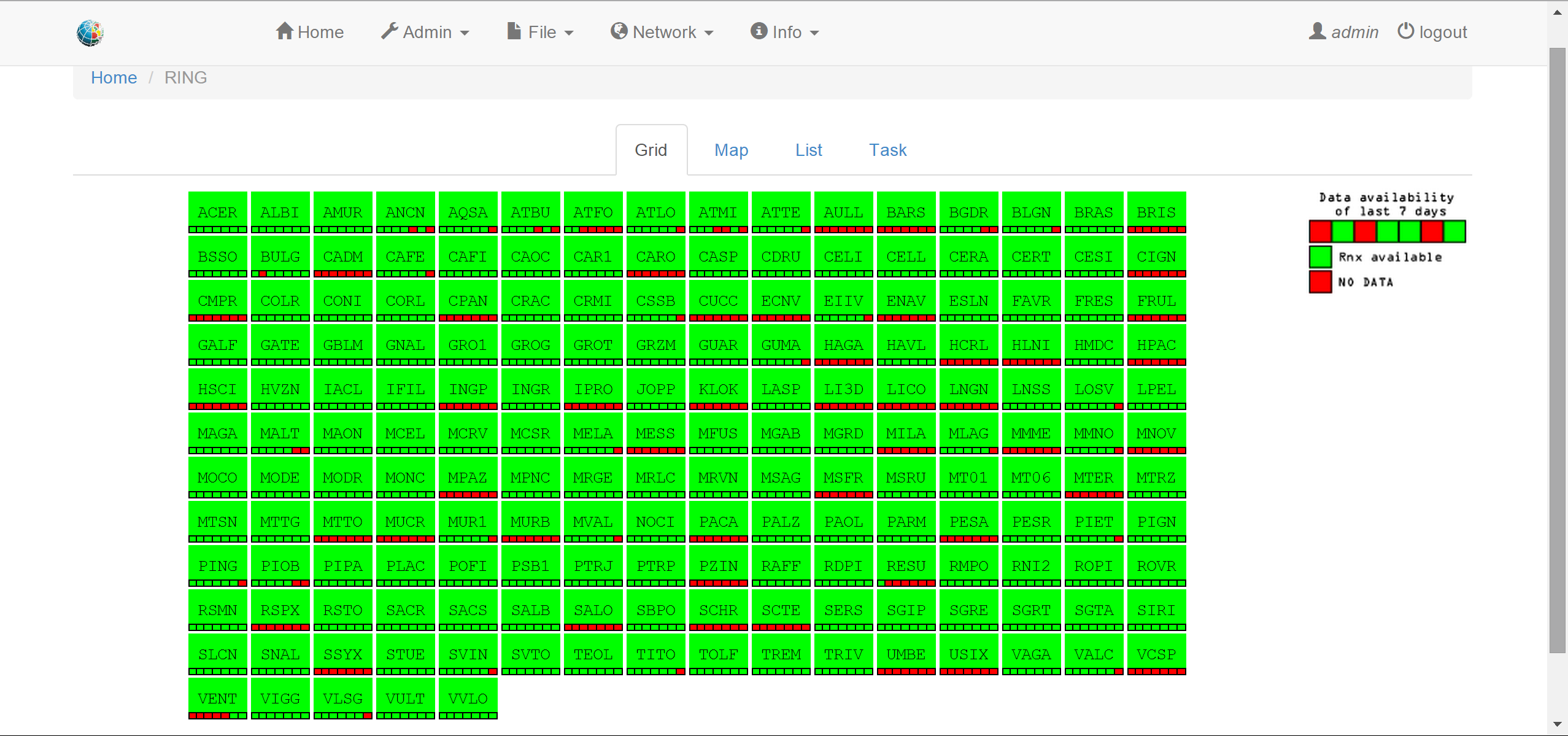
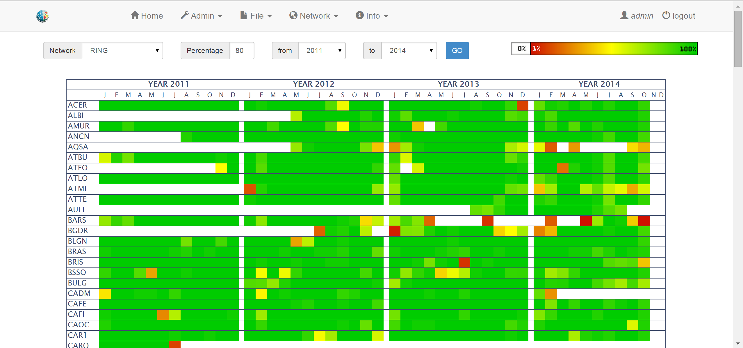
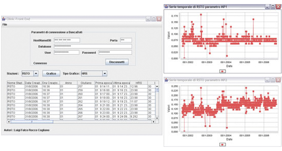
Clinic is a Data Mining Software that checks Rinex Files and produce new information stored into the database. The first check is about: File type, File length, File name.If it is positive, the next step will be TEQC check, otherwise the RINEX file will be put in quarantine. The TEQC check is about: marker name, hours, percent, cycle slips, gaps, first and last epoch, sessions. If it is positive, the RINEX file will be put in the outgoing directory and the information will be stored in the relational database (bancadati). The Front End version of Clinic allows us to produce charts about functioning parameters of the Gps Stations (i.e. Mp1, Mp2, SLPS, GAP …)
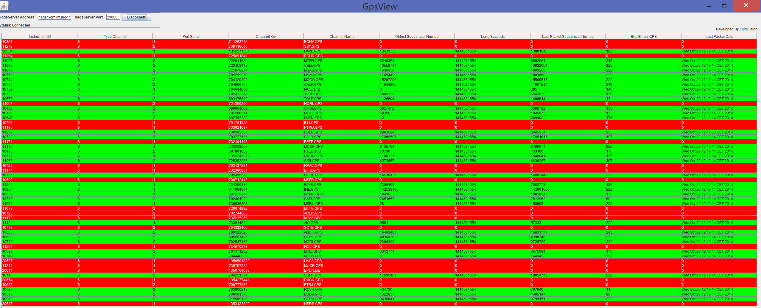
These services were projected with the intent to support data, information and know-how exchanging in the internal structure starting from the principle that the grater source of an organization is the knowledge common to people who are working for. In the monitoring room we have a software for checking the state of health of the GPS stations. In particular GpsView in real time shows informations about gps stations received by Satellite such as last packet, binary content, and produce different colour rows to indicate the state of health of station.
GIS
The RING WebGis is a user-friendly interface for reference territorial and cartographic data for the development of the CGPS network. The HTML viewer allows the user to interact with geographical data, storage in a Geodatabase by ESRI ARCGIS,using the common tools of a webgis (territorial navigation, data interrogation, data selection and spatial analysis).

RING today
Presently, we have installed more than 180 receivers connected with three acquisition centers located in Rome, Grottaminarda, and Catania. Receivers are in real time either with Libra-Gui satellite transmission or Intranet connection streaming data at 1 or 30 sec sampling rate. Most of the efforts were dedicated to Southern Italy and Sicily where now station spacing is at the order of 20 25 km in some target regions. Less stations have been installed in northern Italy because of the already existing networks there. The installation program is not yet finished as new stations are under construction up to about 130 as a final stage of the network after three years (2008). Nowadays, the RING represents a technologically advanced infrastructure and a reference point for several regional government institutions and enterprises in the field of the geodesy.