Nowadays, GNSS based services are becoming increasingly demanding in terms of accuracy. Consequently, a deep knowledge of the morphology and dynamics of the ionosphere is required. In fact, It is well known that the ionosphere is the larger source of the errors induced on GNSS signals. On other hand, GNSS signals are useful probes for the investigation of the distribution of the free electrons in the ionosphere. Given the dispersive nature of the ionosphere, it is possible to calculate the number of free electrons contained in a portion of the ionosphere starting from the measurements of two GNSS signals at different frequencies. In particular, the main ionospheric parameter derived from GNSS measurements is the Total Electron Content (TEC) that is the number of the free electrons contained in a column with a base of 1 meter square. TEC is usually measured in TEC units (TECu) corresponding to 1016 electron/m2.
IONORING exploits the dense RING network and ad hoc algorithms developed by the Upper Atmosphere Physics group of the INGV to monitor the ionosphere over Italy in real-time. This gives the opportunity to nowcast the distribution of the TEC with a very fine spatial resolution (0.1° x 0.1° latitude, longitude) every 10 minutes. These maps are useful to:
- support ionospheric error mitigation in GNSS single frequency positioning;
- study the ionospheric response to external forcing (e.g. strong solar and geomagnetic storms);
- investigate the ionospheric coupling with the neutral atmosphere.
The map in real-time is available at ionos.ingv.it/ionoring/ionoring.htm and the archive data will be soon available via ftp.
Check the updates on the IONORING website!
Contact person: Claudio Cesaroni, claudio.cesaroni@ingv.it
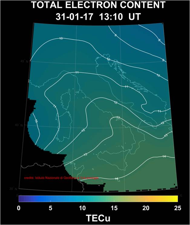
Figure 1. Example of TEC nowcasting map from IONORING