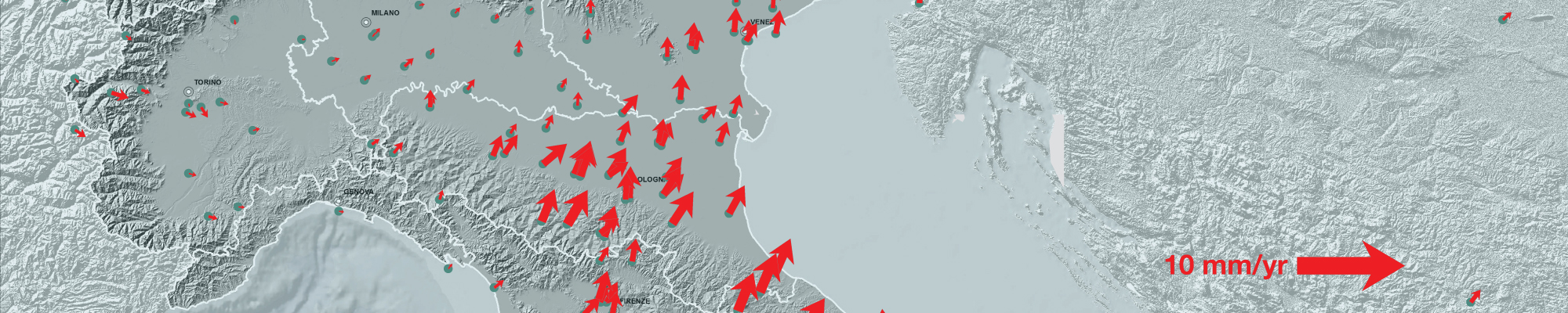
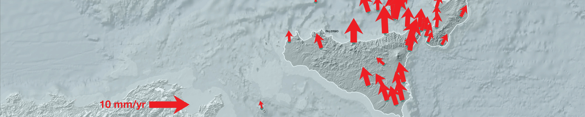
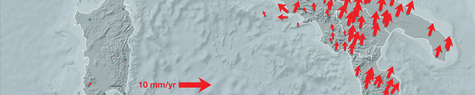
The RING is an open research infrastructure whose data and results are useful for many scientific applications and INGV projects. We have created the conditions to develop innovative research and to offer a unique occasion of multi-research/multidisciplinary approach to Earth science. However, the long term sustainability of RING is a primary goal for the development […]
Preliminary co-seismic displacement for 2019 November 26 Mw 6.4 earthquake in Albania from the analysis of GPS stations INGV-ONT Geodesy Lab Working Group and Rexhep Koci ª, Llambro Duni ª, Neki Kuka ª ª Department of Seismology, Institute of Geosciences, Energy, Water and Environment Tirana, Albania Following the 2019 November, 26 MW 6.4 earthquake, INGV, […]
Nowadays, GNSS based services are becoming increasingly demanding in terms of accuracy. Consequently, a deep knowledge of the morphology and dynamics of the ionosphere is required. In fact, It is well known that the ionosphere is the larger source of the errors induced on GNSS signals. On other hand, GNSS signals are useful probes for […]
Since August 24, 2016, the central Apennines (Italy), between the towns of Amatrice and Norcia, have been struck by a huge and long seismic sequence consisting in five moderate magnitude earthquakes (5.4 <= Mw <= 6.5) and about 45000 aftershocks (http://cnt.rm.ingv.it). Details about these main events are summarized in Table 1, whereas their location […]